GIS-Based Master Plan formulation for Namchi Planning Area
Client:
Urban Development Department, Government of Sikkim
Location:
Namchi, Sikkim, India


Client:
Urban Development Department, Government of Sikkim
Location:
Namchi, Sikkim, India
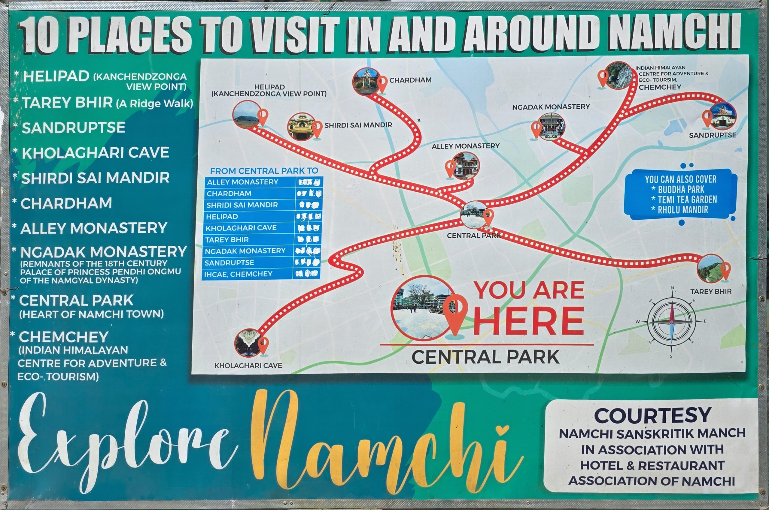
With the national vision of Viksit Bharat@2047 as a guiding framework, Namchi is rapidly transforming into an administrative, cultural, and economic hub in southern Sikkim. This growth requires a coordinated planning framework to ensure the preservation of environmental and cultural assets. Therefore, the GIS-Based Master Plan for the Namchi Planning Area was initiated to align guide and align future development.
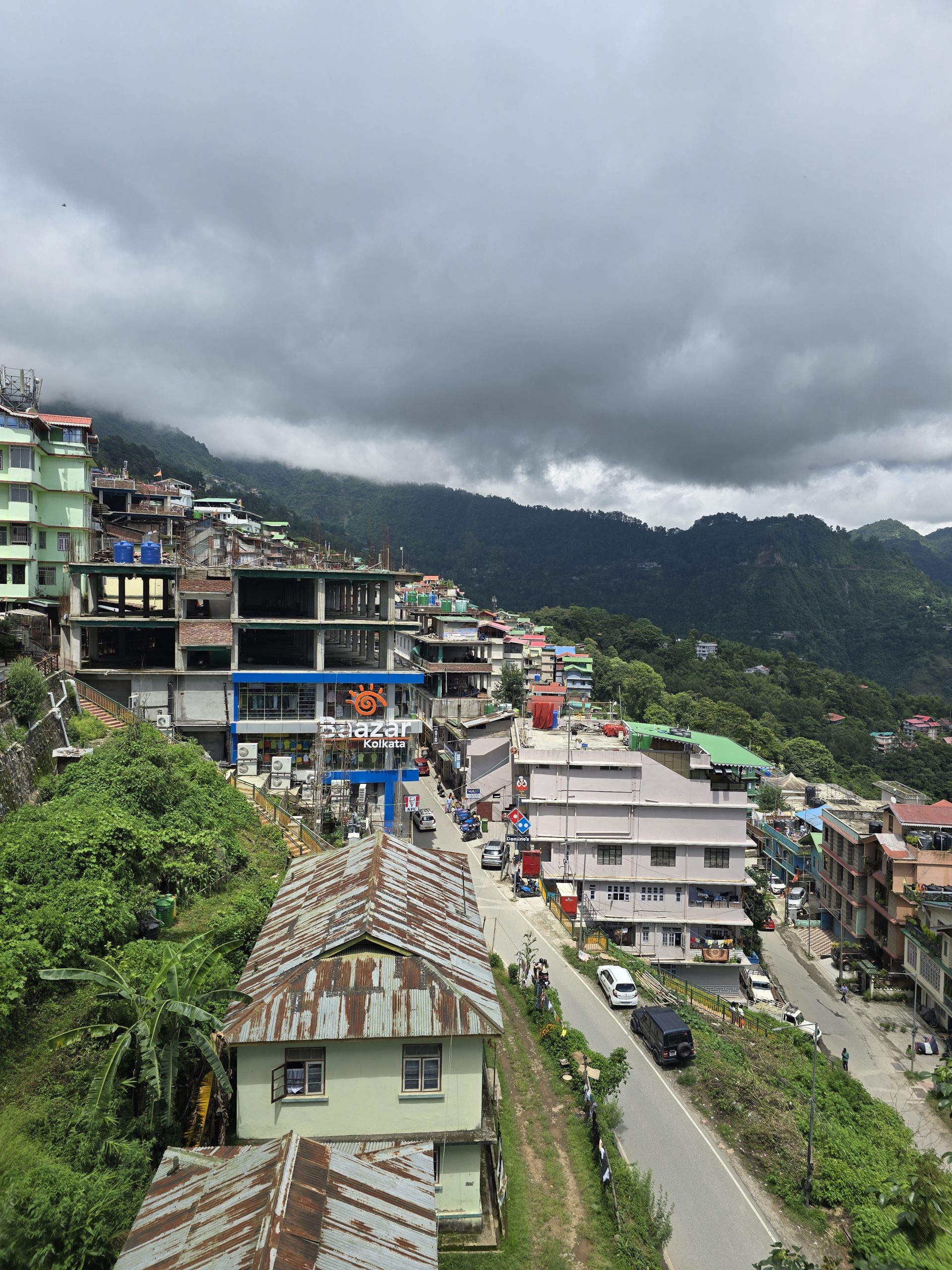
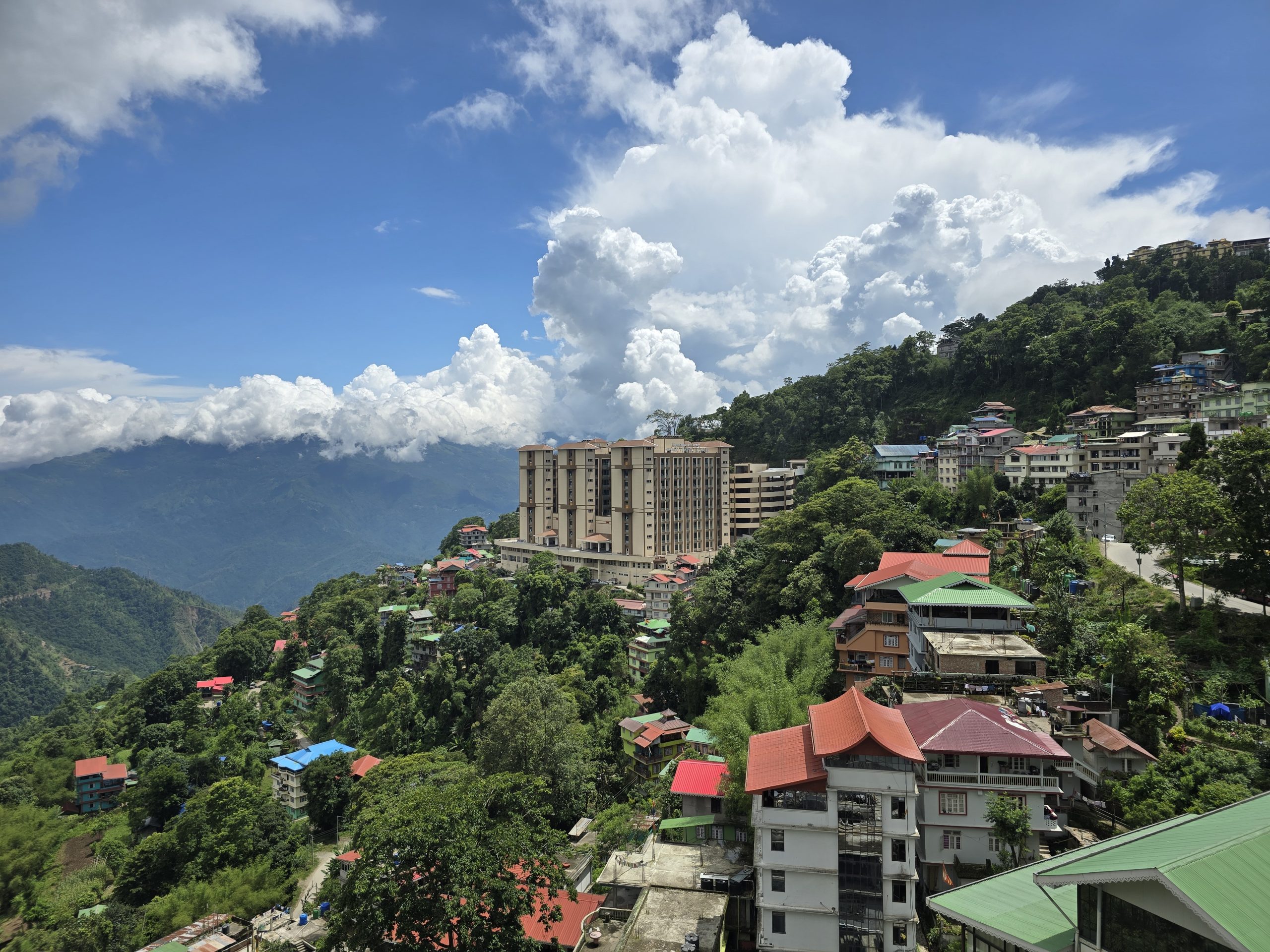
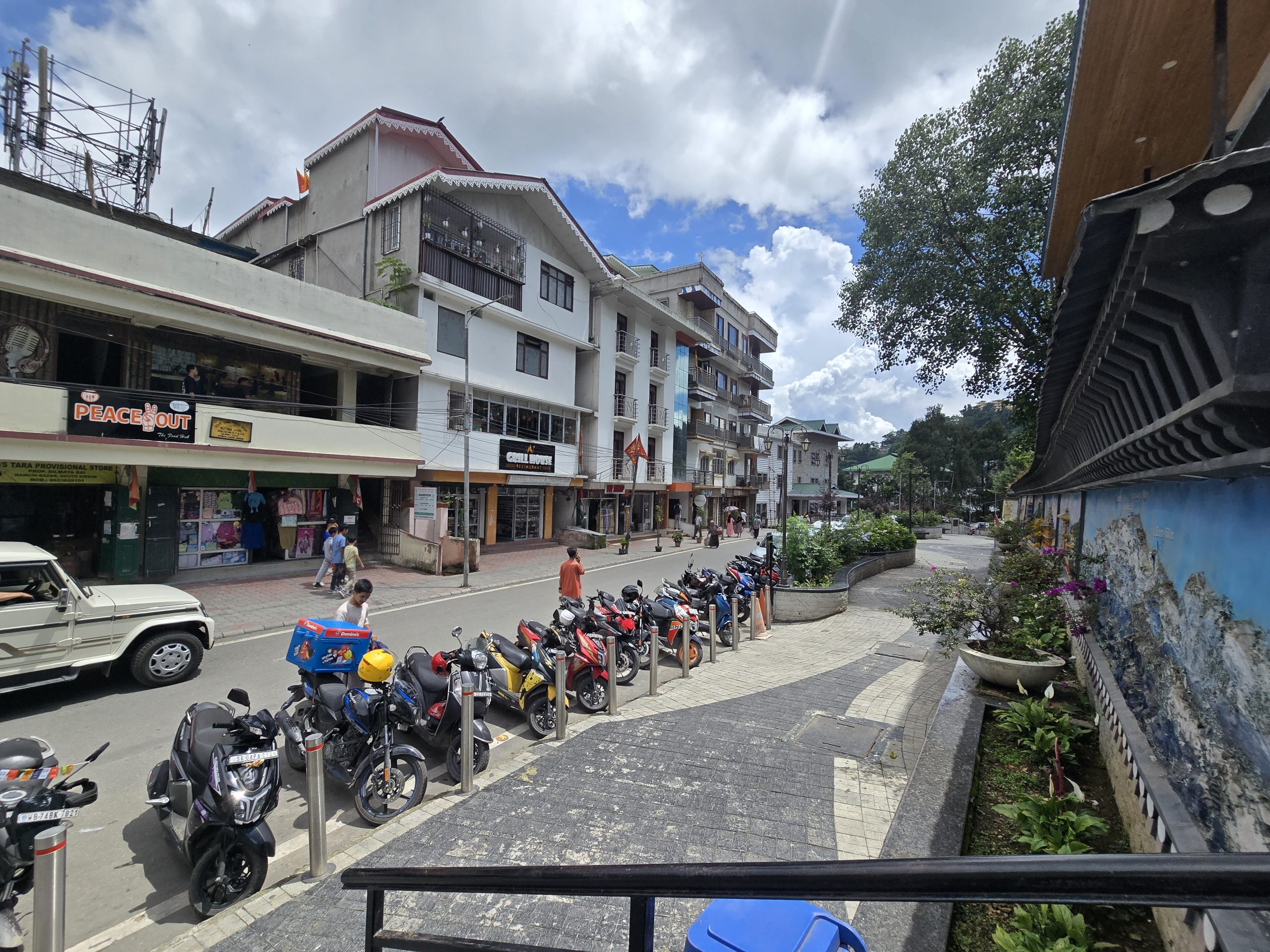
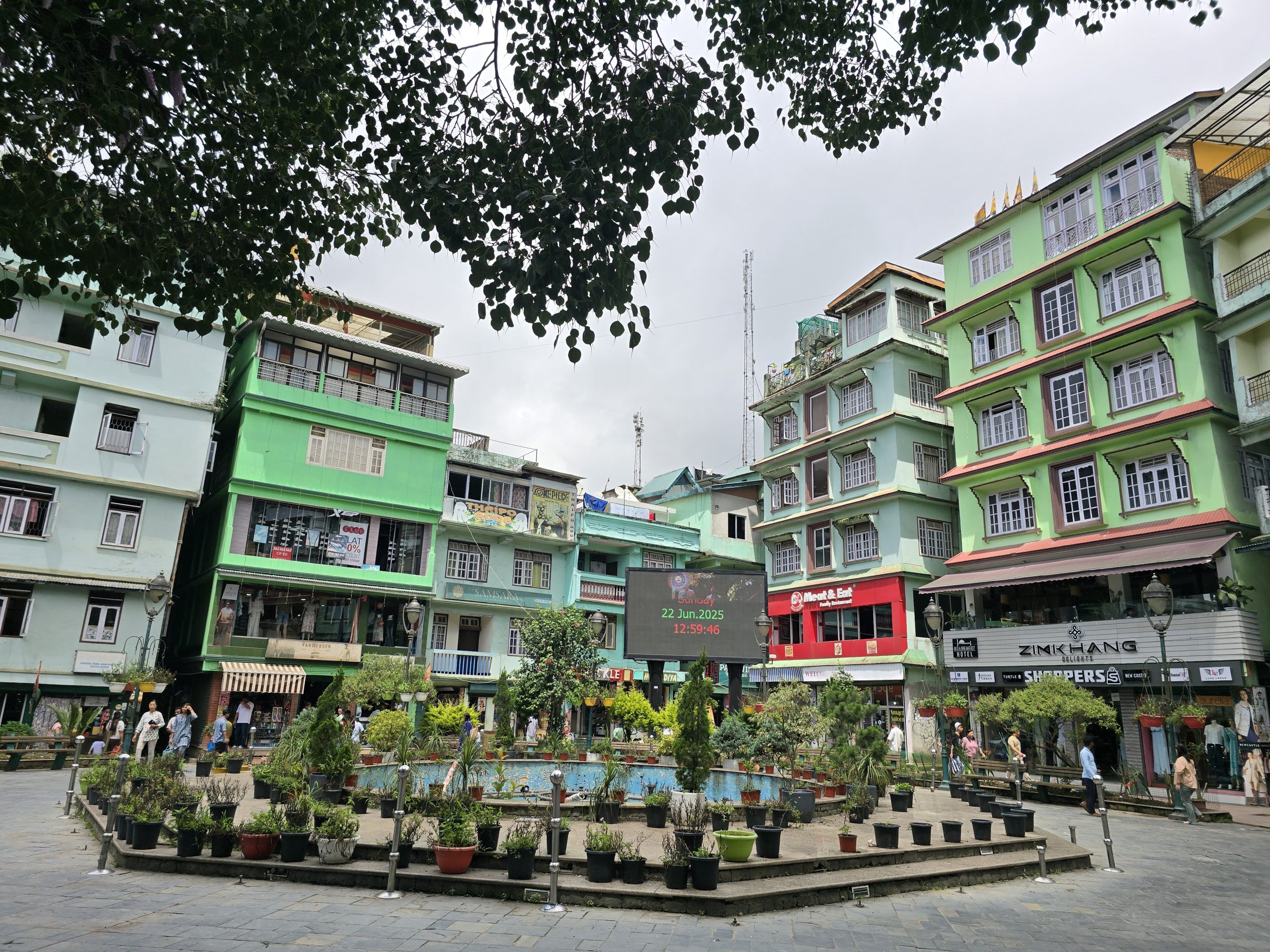
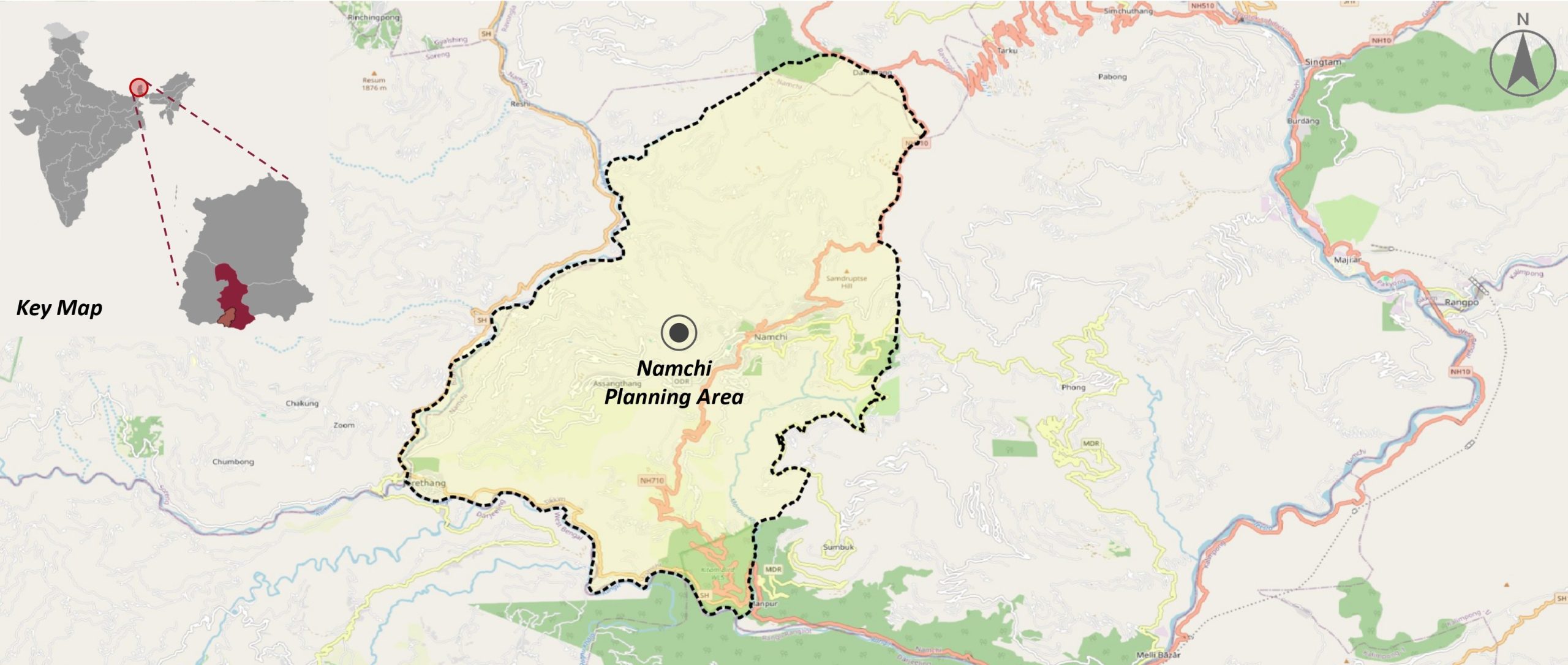
Covering an area of 99 sq.km, the planning area includes Namchi Municipal Council, Nayabazaar–Jorethang Nagar Panchayat, and surrounding revenue blocks, shaped by complex terrain and a wonderful mountainous landscape.
The project focuses on preparing a comprehensive GIS-based Master Plan, gounded in data, policies, and community participation. To assess existing conditions and identify infrastructure and service gaps, Spatial Decisions team developed a robust spatial database using satellite imagery, field surveys, and ground-truthing. After that, these datasets was analyzed along with stakeholder consultations to shape a shared vision and development strategies focusing on multiple sectors. The Master Plan was formulated in accordance with state regulations to ensure legal compliance and long-term applicability.


The Master Plan provides a clear and actionable roadmap for inclusive, balanced, and sustainable urban development in Namchi. By integrating spatial analysis, community inputs, and regulatory frameworks, the plan supports informed decision-making, coordinated investments, and phased implementation. The outcome would position Namchi as a model for planned growth in Sikkim, enabling development that is resilient,sustainable, and aligned with the region’s unique environmental and cultural context.