ENHANCING DISASTER MITIGATION USING GIS AND REMOTE SENSING FOR TU MO RONG DISTRICT, KONTUM
Client: ActionAid International in Vietnam | Duration: June 2011 – October 2011 | Location: Vietnam

Client: ActionAid International in Vietnam | Duration: June 2011 – October 2011 | Location: Vietnam
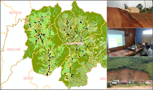
About: ActionAid International in Vietnam (AAV) is working for Disaster Risk Reduction (DRR) and Disaster Risk Management (DRM) in Kontum Province post Ketsana Typhoon. They are specifically providing relief measures to the affected communities in the district of Tu Mo Rong. To further enhance the mitigation and adaptive processes, AAV envisaged providing support to the Department of Natural Resource and Environment (DoNRE) and the Department of Agricultural and Rural Development (DARD) with GIS and Remote sensing capabilities for DRM/DRR. Spatial Decisions were assigned with a task to create customized software with customized database and reporting means along with support for geography. Further, provision for a training program for capacity building at DoNRE and DARD was undertaken.
Specific tasks include:
Creation of Base Data for Tu Mo Rong District.
Creation of customized Geodatabase for collection of geographic and non-geographic information related to DRM/DRR.
Development of customized GIS software using Microsoft .Net and ESRI ArcEngine Technologies following software life cycle development.
Deployment of the software at the end-user.