

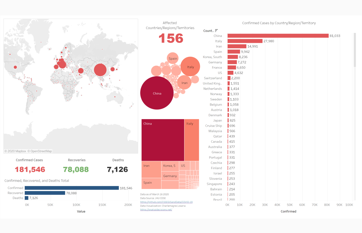
Aside from always maintaining good hygiene, another good thing that the COVID-19 Pandemic has thought the public is how important geographic information is, most especially when trying to visualize and understand the spread of the virus and a key part in helping governments make plans to curb the situation.
Many COVID-19 dedicated dashboards are existing already. We at Spatial Decisions love dealing with data and we love to communicate it simply for the general understanding of the public. We developed our own dashboard to track the COVID-19 pandemic and we are using the data from John Hopkins University CSSE.
You can access our interactive dashboard here